Trail Trials: Mount Rogers
- Tim Murphy

- Jan 13, 2019
- 6 min read
Updated: Apr 24, 2021
Mount Rogers, measuring in at 5,729 feet above sea-level, holds the distinction as the tallest point in Virginia and the fourth-highest peak east of the Mississippi River. The summit displays the northern-most example of a Southern Spruce-Fir Forest in the nation, supports the habitats for wild horses, and offers some of the most breath-taking views in the region. Hikers wishing to experience this splendor can take an 8.5-mile out-and-back trail from Massie Gap to the summit. But before we get into the hiking review, let’s take a look at the peak’s namesake—William Barton Rogers.

Rogers was born in Philadelphia, Pennsylvania, on December 7, 1804. He received much of his childhood education from his father, Patrick Kerr Rogers—a medical graduate from the University of Pennsylvania. In 1819, the Rogers family moved to Williamsburg, Virginia, following Patrick’s appointment as a Professor of Natural History and Chemistry at the College of William and Mary. William, himself, attended the College as an undergraduate. After completing his studies, William moved to Baltimore, Maryland, where he and his brother, Henry, opened a school in the neighboring town of Windsor.
William succeeded his father as a Professor of Chemistry and Natural Philosophy at William and Mary following his death in 1828. In 1835, Rogers was appointed the first state geologist of Virginia and conducted the state’s first comprehensive geological survey. That same year, Rogers was hired by the University of Virginia as a Professor of Natural Philosophy.
In 1853, Rogers moved to Boston, Massachusetts, and became an orator with the American Academy of Arts and Sciences. In 1860, Rogers lobbied the Massachusetts State Legislature (on behalf of the Associated Institutions of Science and Arts) for the establishment of an educational, polytechnic institute. Rogers’ proposal was approved by the legislature in 1861, and in April of that year, the Massachusetts Institute of Technology (MIT) was formally chartered. However, due to the financial and logistical difficulties of the Civil War, the first classes at MIT were not conducted until February 1865.
Rogers served as MIT’s first President from 1865 to 1870. He retired after the fifth year of his term due to declining health; however, his retirement didn’t last very long. Rogers was asked to resume his role as President of MIT in 1878, following financial hardships and low enrollment rates at the Institution. Rogers agreed and held the position until 1881. William Barton Rogers died suddenly on May 30, 1882, while delivering diplomas to graduating students at MIT’s commencement ceremony.

Rogers lived a full and fruitful life as an intellectual and educator. He is remembered today as the founder of MIT and the father of modern laboratory-based instruction. The summit that bears Rogers’s name stands as a testament to his legacy and passion for the natural sciences.
As mentioned before, the trail leading to the Mount Rogers summit is an 8.5-mile out-and-back path that originates at Massie Gap in Grayson Highlands State Park. The park does require a modest entrance fee that ranges between $2 and $7, but the price of admission is well-worth the hike. The Massie Gap parking lot is a couple miles up the road past the entrance gate.
I followed the Rhododendron Trail up the side of the ridge for the first 1/3 mile of my journey. This section of the trail used to be a wagon road during the late 19th and early 20th centuries. During the spring and summer months, the rhododendron shrubberies that line the path are in full bloom, as are the wild huckleberry bushes scattered across the landscape.
At the end of the Rhododendron Trail, I reached the junction of the Virginia Highlands Equestrian Trail. I made a left onto this path and continued on until I got to the Appalachian Trail. The intersection of these trails is clearly marked by signs and white blazes. I made another left and continued southbound on the AT until I reached the state park boundary, marked by a gate ¾ miles away. Going through the gate allows hikers to enter the Mount Rogers National Recreational Area.
About ¼ mile away from the gate is another trail junction between the Wilburn Ridge Trail (marked by blue blazes) and the AT. The Wilburn Ridge Trail, though more strenuous than the Appalachian, leads hikers to a couple of prominent rock outcroppings that offer picturesque, panoramic views. I, being my adventurous self, followed Wilburn Ridge and was left in awe by the sights! Unlike other places I’ve hiked, the majority of the mountain is a high-altitude grassland (called a “bald”), void of trees and obstructive foliage. This offered magnificent, unhindered views atop the rocks that extended into the neighboring states of North Carolina and Tennessee. Once I had my fill of the sights, I continued down the Wilburn Ridge Trail for another mile until it reconnected with the AT.

Along the way, I saw my first herd of wild ponies! These ponies were introduced to the area in 1975 and are descendants of Shetland breeds of Scotland. Shetlands are short and stocky compared to the large, muscular, Spanish-bred stallions commonly seen on many farms today. There are roughly 150 ponies on the mountain, all of which are protected by the Wilburn Ridge Pony Association. The ponies are incredibly docile; however, hikers should exercise caution when encountering them since they are still wild animals. For your own and the horses’ safety, don’t sneak up on them and definitely do not feed them!
After spending some time admiring the ponies, I continued down the Appalachian Trail for another mile and passed by the Thomas Knob Shelter before reaching the Mount Rogers Spur Trail. This ½ mile trail leads hikers into the Spruce-Fir Forest and eventually ends at the geographical survey markers at the summit. Since a dense forest surrounds the peak, there isn’t much of a view at the top, but it’s still incredible to stand atop the tallest point in Virginia!
While the trail is rated as strenuous, I felt that it wasn’t all that difficult to complete. The total elevation gain going up is around 1100 feet, but it doesn’t feel very steep. Sure, there were some sections of trail that were steeper than others, but nothing absurdly vigorous. The rating is probably due to the length more than anything else. Another factor may be the air quality. At high altitudes, the air is noticeably thinner than at sea-level. A lower concentration of atmospheric oxygen means less oxygen delivered to your bloodstream per breath. Higher altitudes also decreases air pressure, which caused my ears to pop periodically as I hiked up, and that’s perfectly normal if you experience the same thing, too. Just make sure that, if you do go on this hike, you are well-conditioned and take your time on the trail.
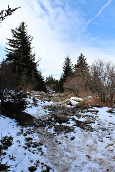
The hike to Mount Rogers took me roughly 4 hours to complete; however, hikers may spend an entire day on the summit. It had recently snowed on the mountain when I went, so the hiking was rather icy and treacherous in certain areas. However, I took my time and managed to avoid injury. The Appalachian Trail does get a little confusing after crossing Wilburn Ridge and the lack of signage doesn’t help (granted I made a couple wrong turns along the way), but as long as you look for the landmarks I mentioned along the trail, you should be fine.

But my Mount Rogers experience isn’t over yet! As I was about to leave the park, I noticed that my bike rack was a bit loose, so I set my wallet down on my tailgate as I tightened a few screws. I absent-mindedly forgot to take my wallet off my tailgate before I drove away! I didn’t realize my mistake until I got to Damascus, Virginia, which is about 45 minutes away from Mount Rogers. I frantically drove back to the Grayson Highlands State Park, hoping and praying that it was still there. Miraculously, I spotted my wallet on the side of the road in a pile of snow adjacent to my original parking spot! A breathed a huge sigh of relief and said goodbye to the mountain once more.
I had a remarkable time at Mount Rogers. It is definitely the trifecta of trails—beautiful scenery, intimate wildlife, and a hike beyond exhilaration! The ponies were the icing on the cake for me. They were so majestic and beautiful, I wanted to take one home…and it turns out you can! Every September, the Wilburn Ridge Pony Association rounds up a few select ponies from the mountain and auctions them off at a local fundraiser. The purpose of this is two-fold: 1) it prevents the ponies from overpopulating Mount Rogers and 2) the proceeds help fund the preservation of the parks. Perhaps I’ll pay another visit later this year...Trail Rating: 9.5/10


For more information on William Barton Rogers, check out these links from MIT and William and Mary!
For more information on Grayson Highlands State Park, visit the Virginia DCR website!


